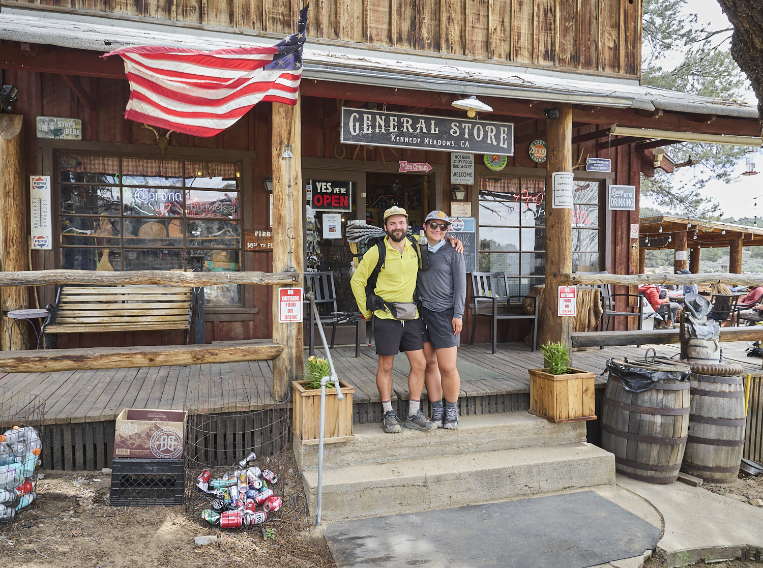
The general store in Kennedy Meadows (South). Kennedy Meadows is known among PCT hikers as the gateway to the Sierra Nevada. Although northbound hikers have technically been in the Sierra Nevada for over a hundred kilometers by this point, this place marks the last outpost of civilization before entering the High Sierra. In a typical year, dozens of long-distance hikers set out from here into the High Sierra each day during May and June. In 2023, however, historic snow conditions meant that only a handful of hikers departed each day. Most chose to pause their thru-hike here and resume the PCT further north at a snow-free section.
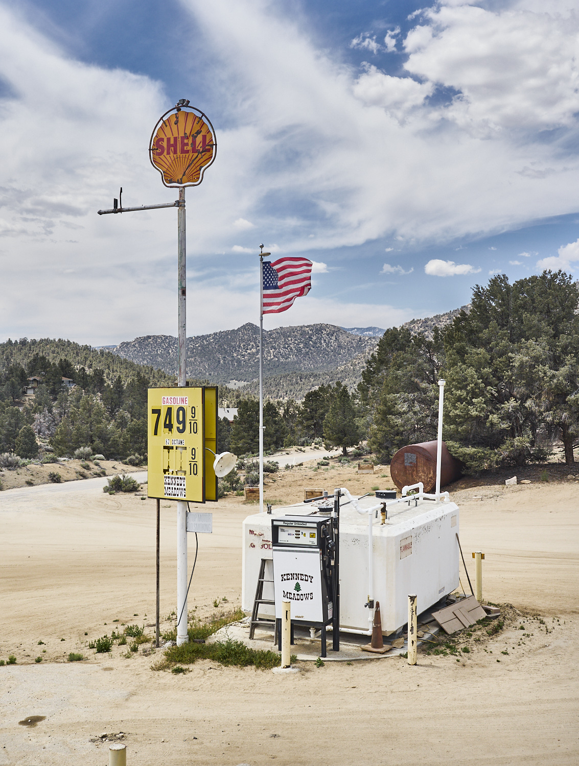
The gas station in Kennedy Meadows (South). The climate is hot and dry — the term “desert outpost” seems fitting. According to the 2020 census, the settlement had 58 residents, though the Kennedy Meadows town sign claims 200. There’s a small general store (which includes the gas station) and a modest but well-stocked outdoor gear shop that opens during hiking season. At night, you might hear loud music and off-key singing — courtesy of a small karaoke bar.
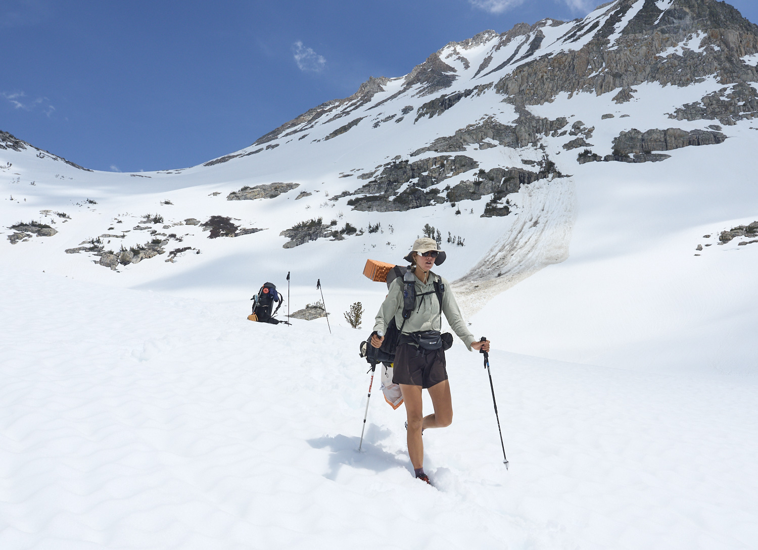
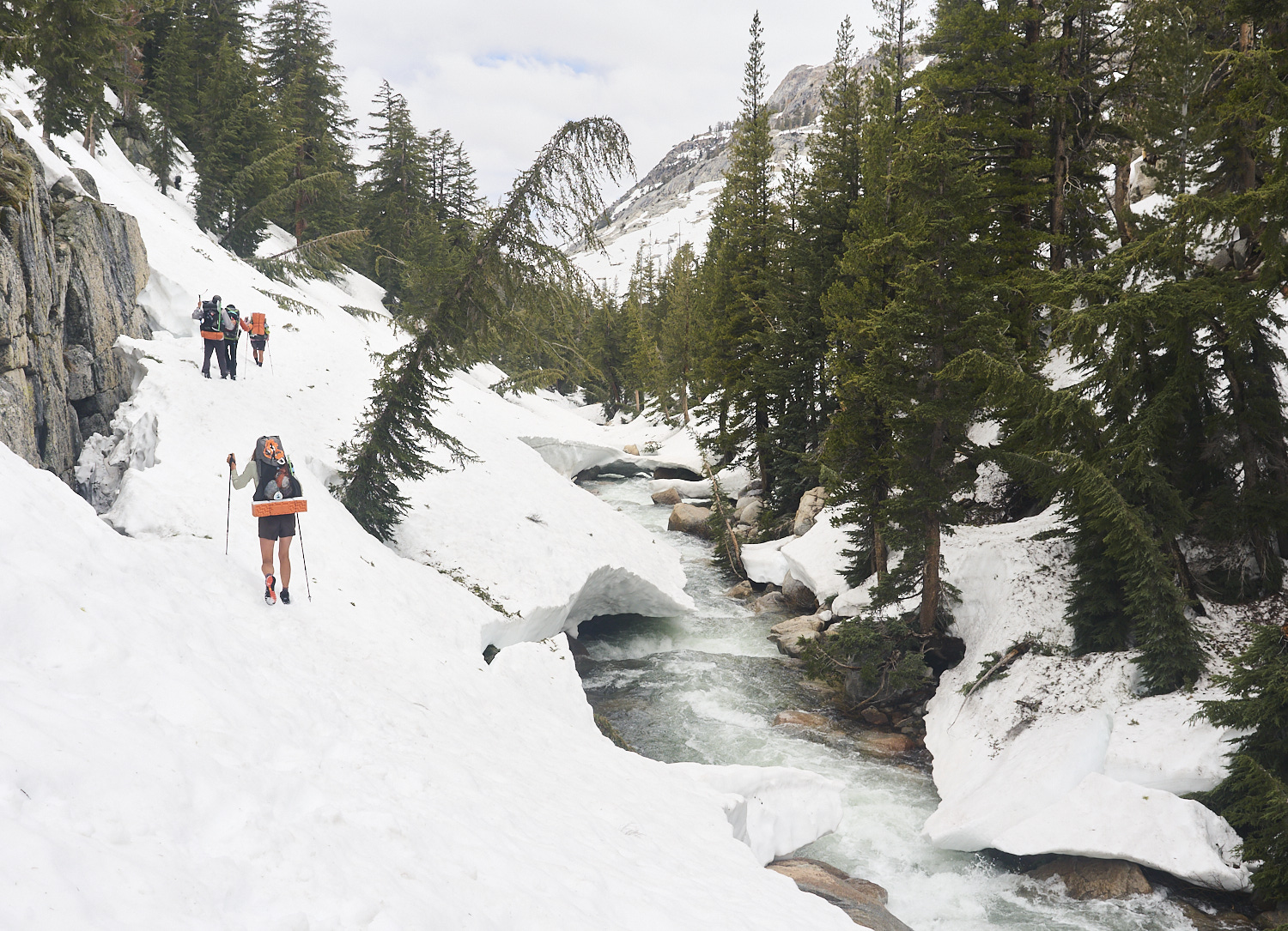
View to the west near Siberian Pass. Just two days north of Kennedy Meadows, the scenery has changed dramatically. At over 3,000 meters (10,000 feet) of elevation, the entire landscape is covered in a snowpack that is, in places, several meters deep. Navigation is usually done via GPS, while hikers try to find the safest and most manageable route based on the terrain. In 2023, long-distance hikers had to contend with these conditions for about five weeks across roughly 600 kilometers (370 miles) of trail.
Early morning ascent of Mount Whitney in Sequoia National Park. At 4,421 meters (14,505 feet), Mount Whitney is the highest peak in California and the contiguous United States ("Lower 48"). Because of its proximity to the PCT, many thru-hikers climb it as part of a day trip.
Magic Hobbit tackles the final kilometers of the John Muir Trail to the summit of Mount Whitney at over 4,000 meters elevation.
Pons is relieved after safely overcoming a difficult-to-cross snow cornice on the John Muir Trail on his way to the summit of Mount Whitney. The PCT runs through the forested part of the valley on the right in the background. In the foreground lies the frozen Guitar Lake.
Return march to civilization via Onion Valley Road. PCT thru-hikers use so-called sidetrails to leave the Sierra over a pass to the east, entering the dry and warm Owens Valley. Finally, there are roads again, along with opportunities to relax and shop. For the first time in many days, cell phone reception is available again. In 2023 hikers often spent more than a week away from civilization on individual sections in the High Sierra.

Hikers enjoy beer and billiards in a saloon in Bishop. Located in the Owens Valley east of the Sierra Nevada, the small town of Bishop is a popular place for hikers to rest after the rigors of the Sierra and to stock up on supplies for the next stretch.
Bishop is a typical American small town located in the Owens Valley in Eastern California.
Gump is recovering at Hostel California in the small town of Bishop after the strains of a strenuous mountain stage.
Lost and Found and Gump in a laundromat in Mammoth Lakes.
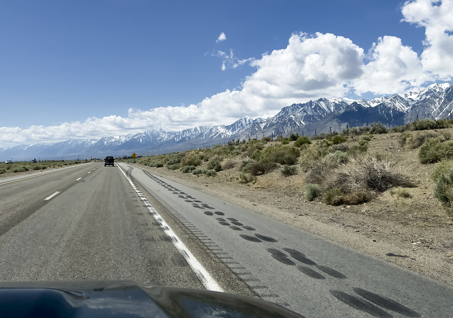
Traveling through the Owens Valley on U.S. Route 395, heading south from Bishop toward Independence. After a rest day in Bishop, the journey continues south on Route 395 to Independence, where a mountain road leads up to Onion Valley. From there, a hiking trail climbs over the 3,569 meter (11,709 ft) Kearsarge Pass and leads back to the PCT in a single day’s hike.
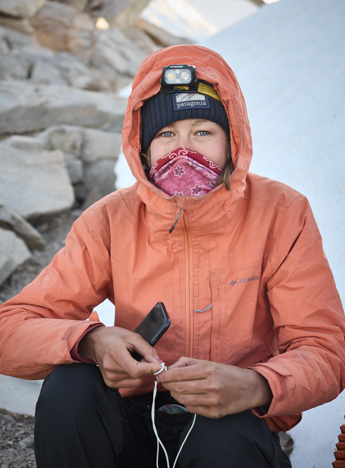
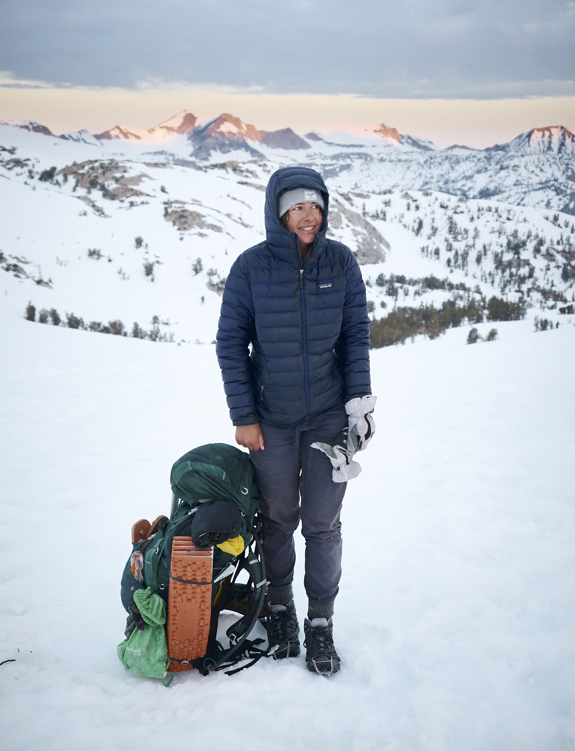
Susan on a cold morning in the Sierra Nevada.
Susan and Gump ascending Glen Pass (3635 meters, 11,926 ft).
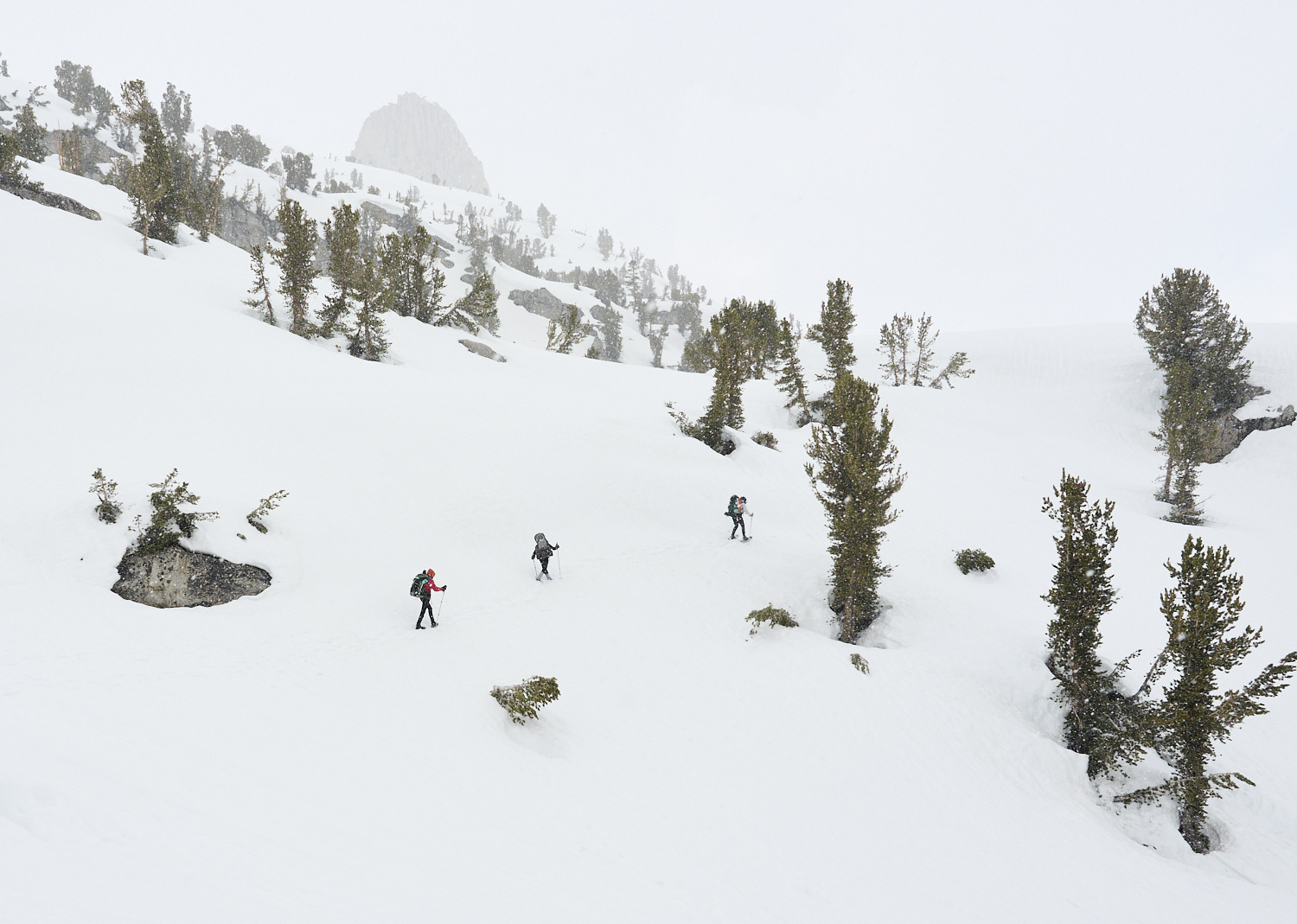
Hikers in Kings Canyon National Park during snowfall.
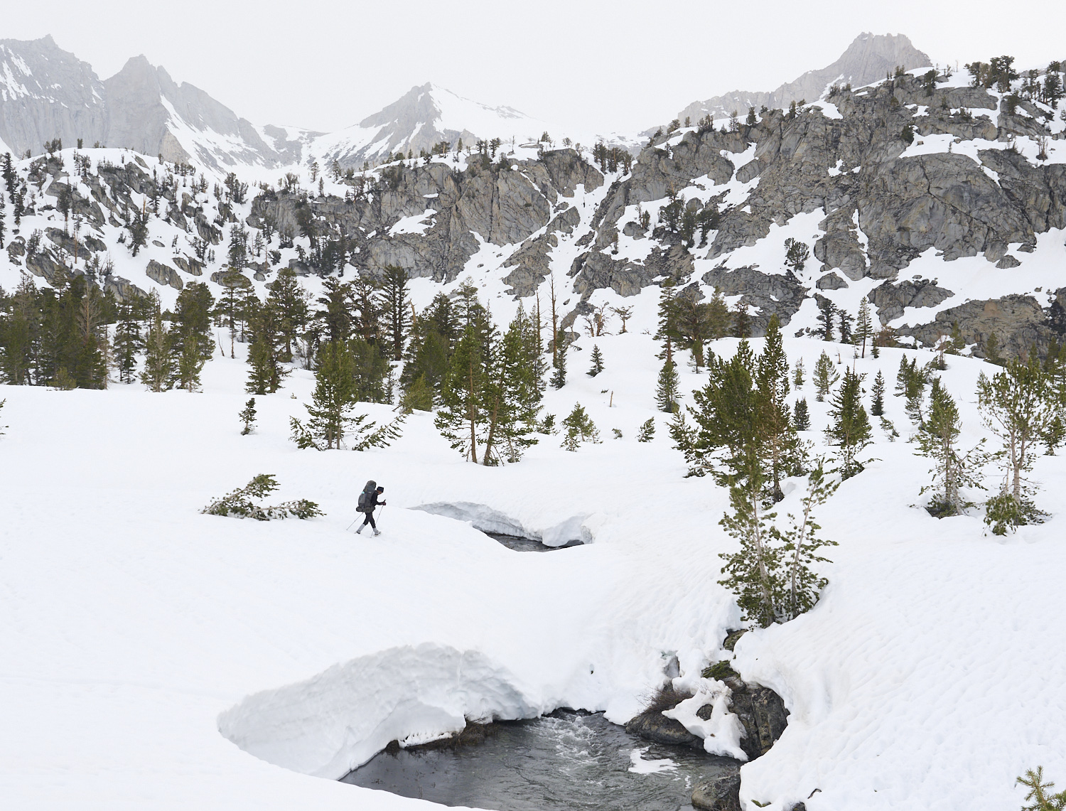
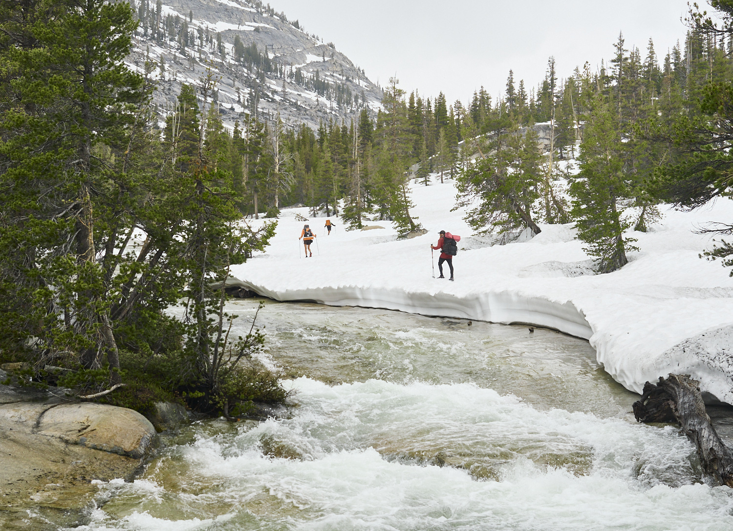
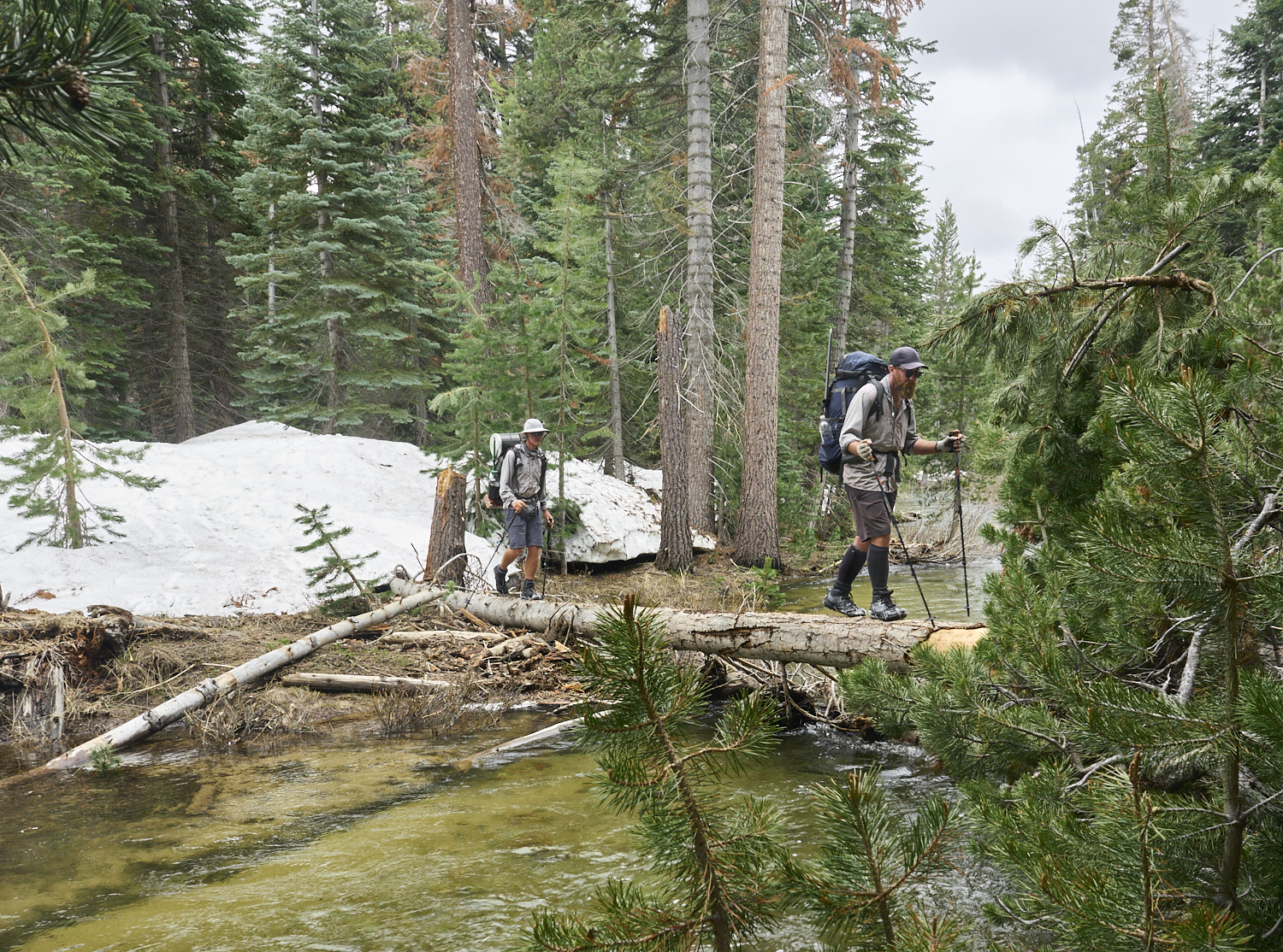
In the deeply snow-covered Sierra Nevada, Oujin crosses a snow bridge in the valley of the South Fork Woods Creek in Kings Canyon National Park. Thanks to the exceptional snowpack, many rivers could be crossed safely and easily on solid snow bridges.
Gump crosses the South Fork Kings River.
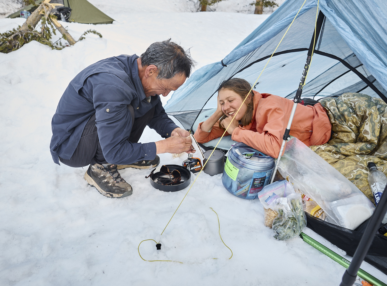
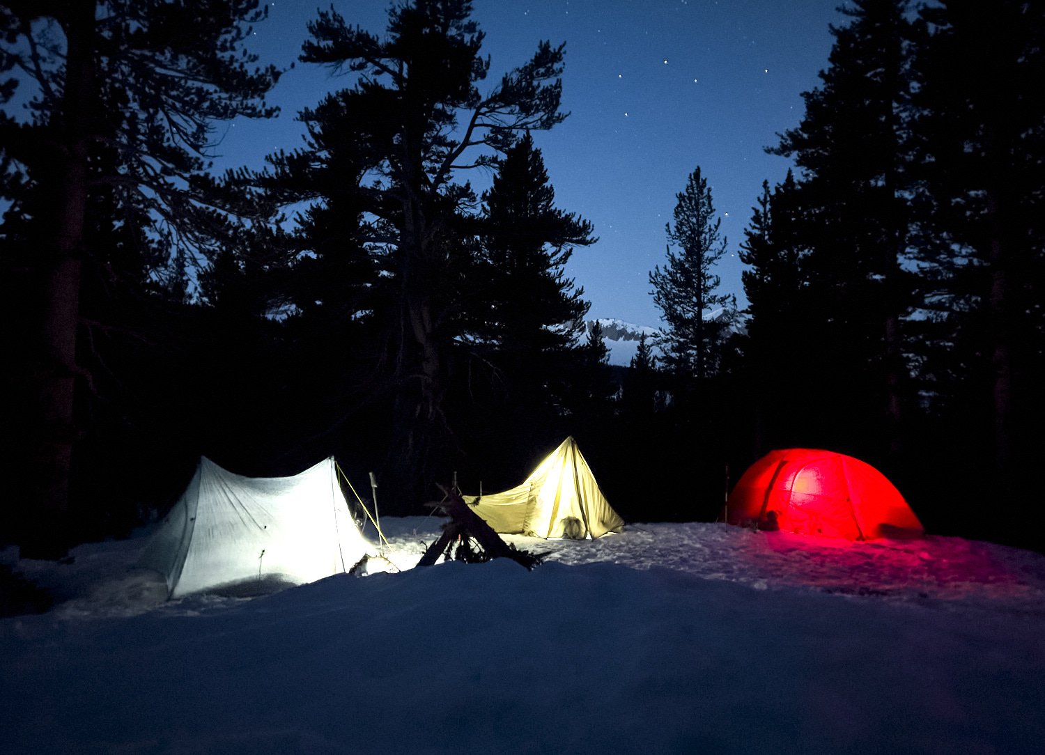
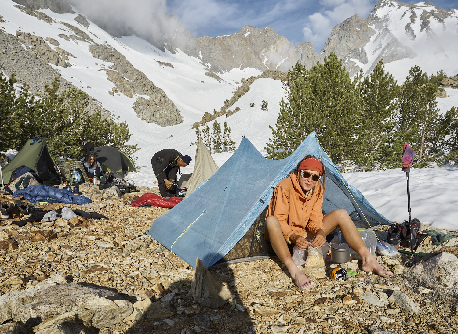
Evening mood at camp with Susan and Oujin. In the spring and early summer of 2023, thru-hikers in the High Sierra mostly pitched their tents on snow.
Early start at 4:40 AM in the morning. During night temperatures hit lows under 0°C. Frozen snow allows faster and easier hiking in the morning. After noon the warm sun is melting the snow. The resulting slushy snow makes hiking again slow and exhausting.
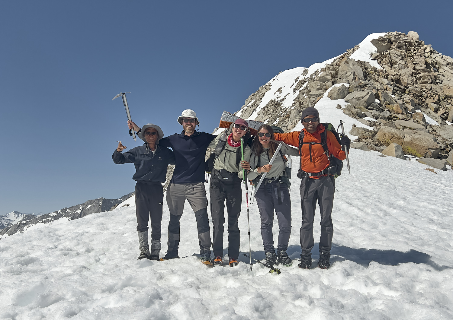
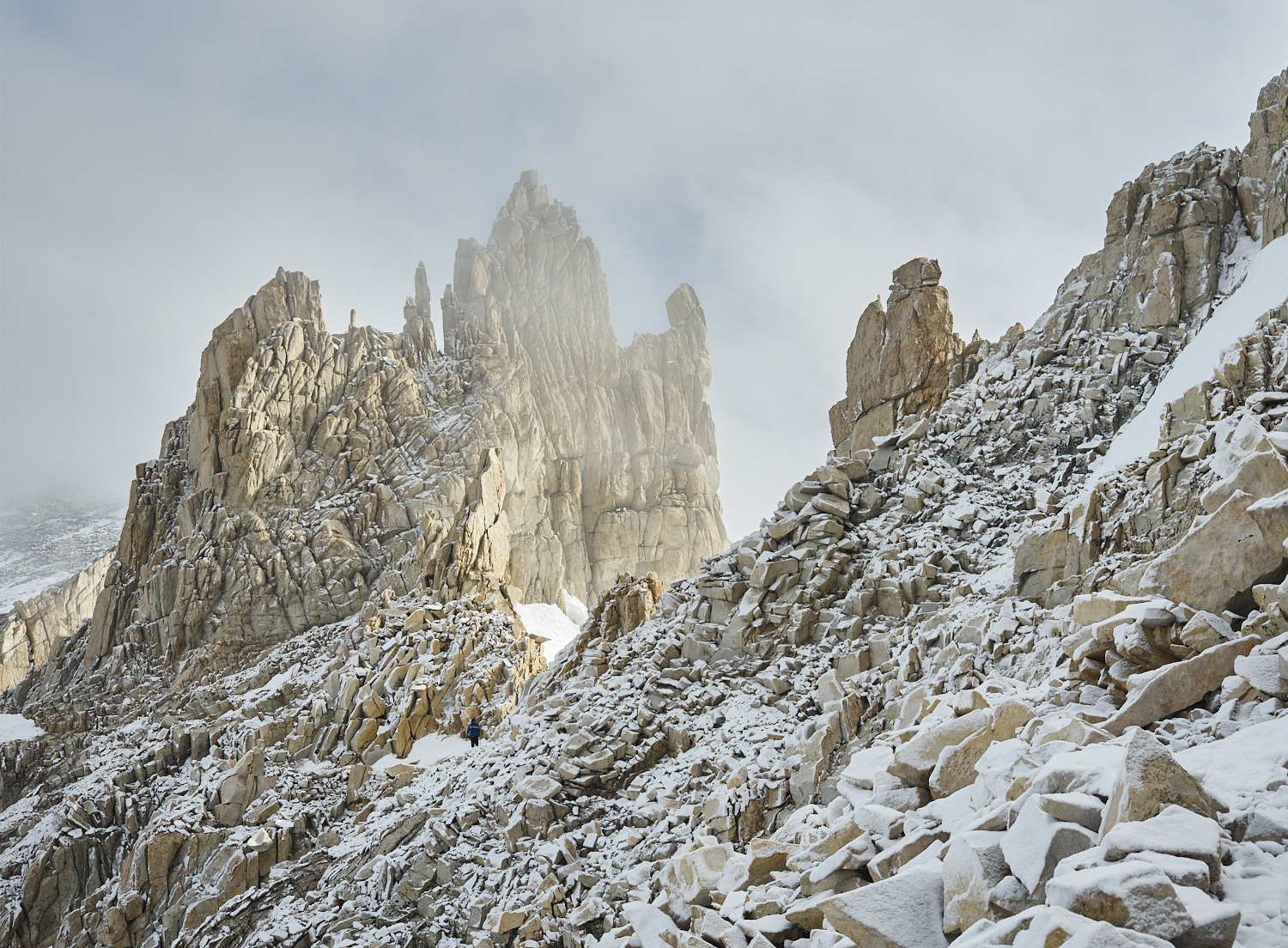
Group photo at Mather Pass. In spring the snow-covered Mather Pass is considered one of the most challenging passes on the PCT.
From left to right: Oujin, me, Susan, Lost and Found, and Gump.
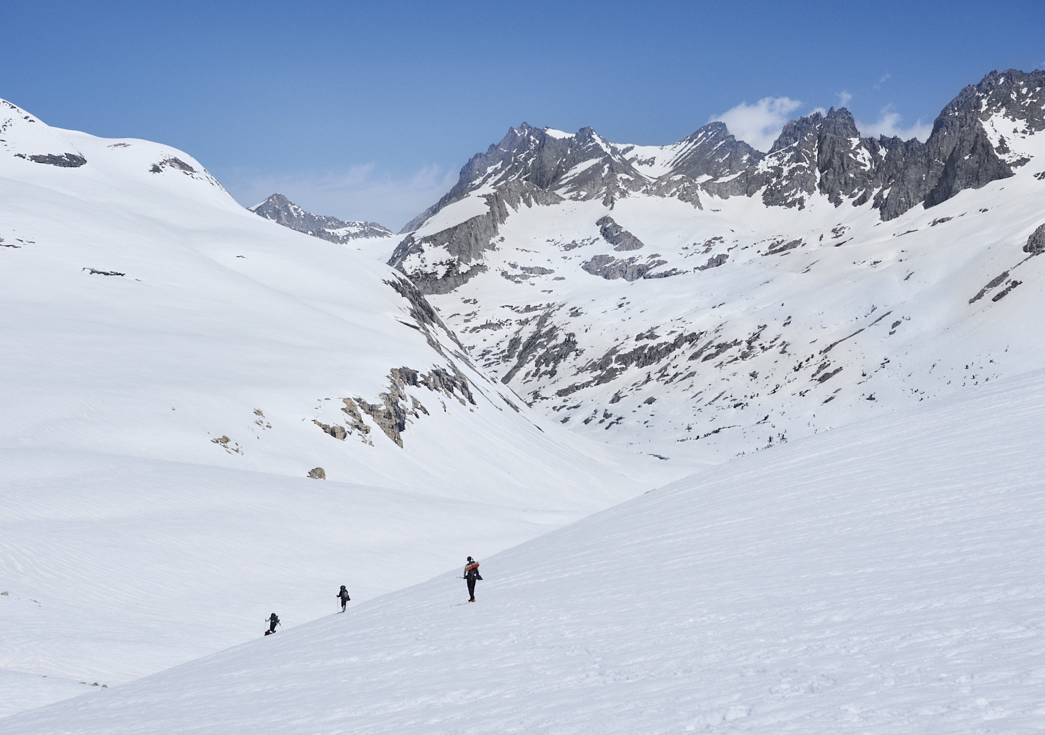
Descent from Mather Pass to Upper Palisade Lake. In the center of the image in the background, North Palisade is visible. At 4,343 meters (14,251 feet), it is the third-highest peak in the Sierra Nevada.
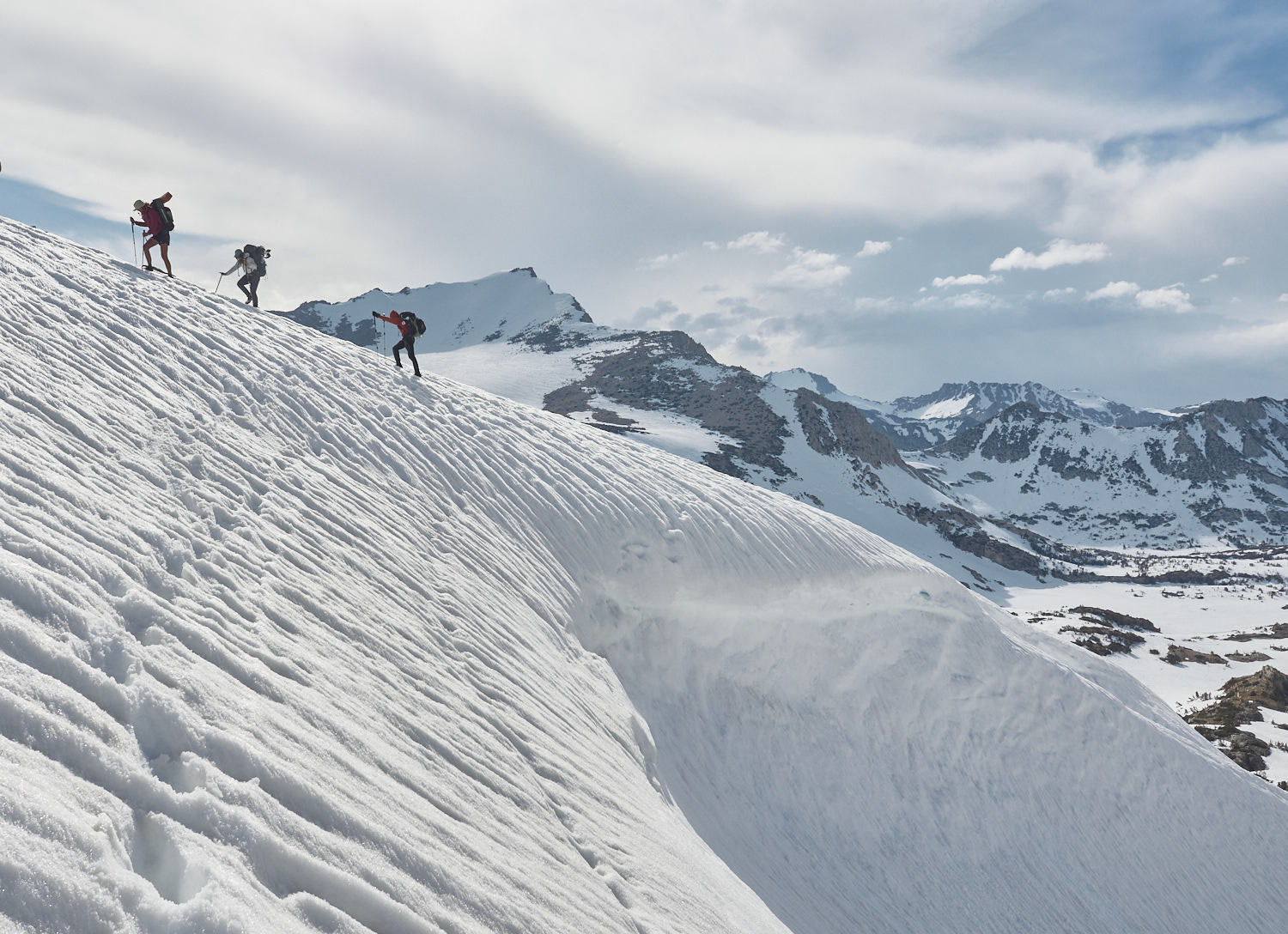
Susan crosses the runout zone of a wet snow avalanche.
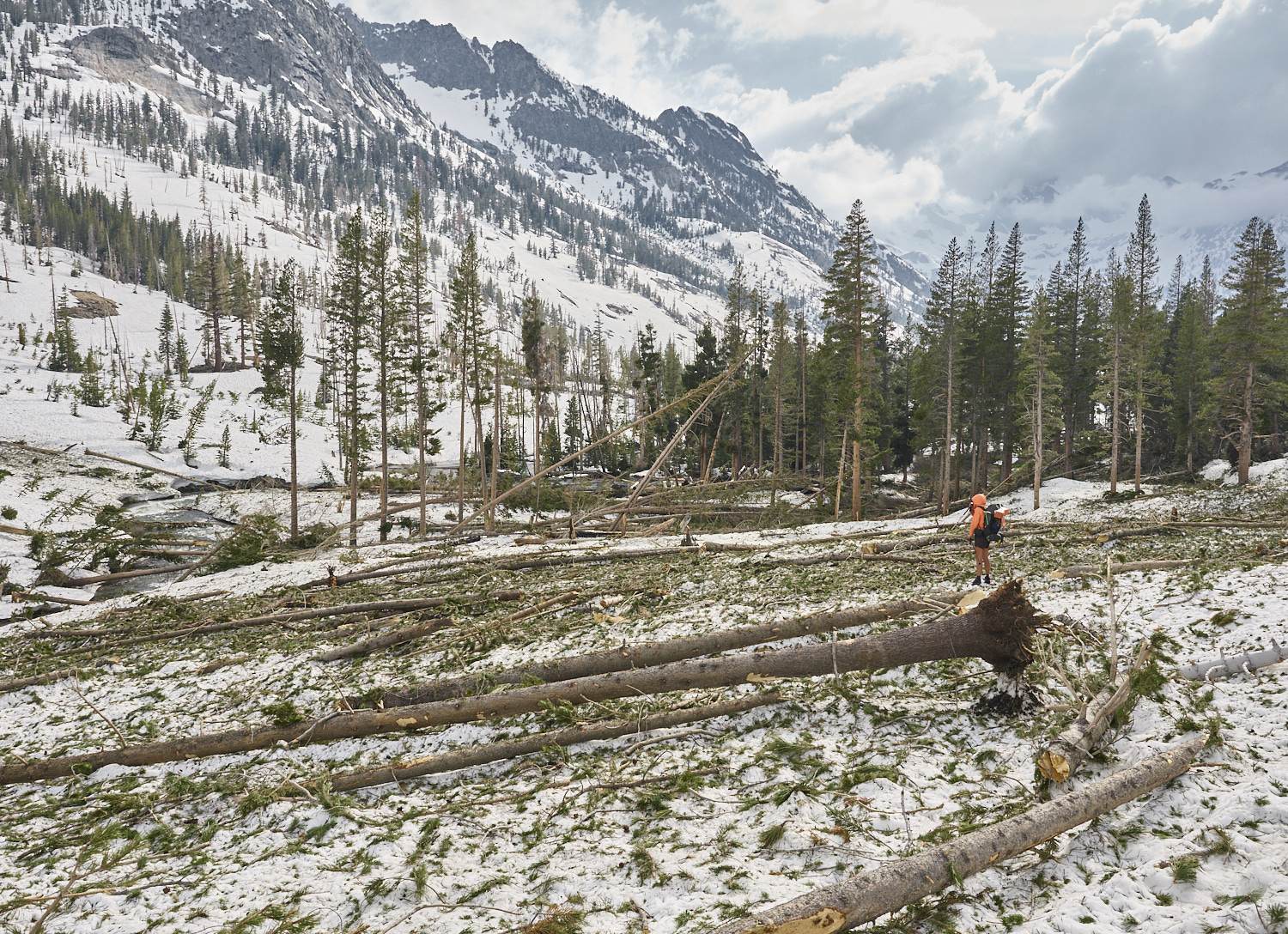
Susan stands in a destroyed stretch of forest, torn apart by an avalanche.
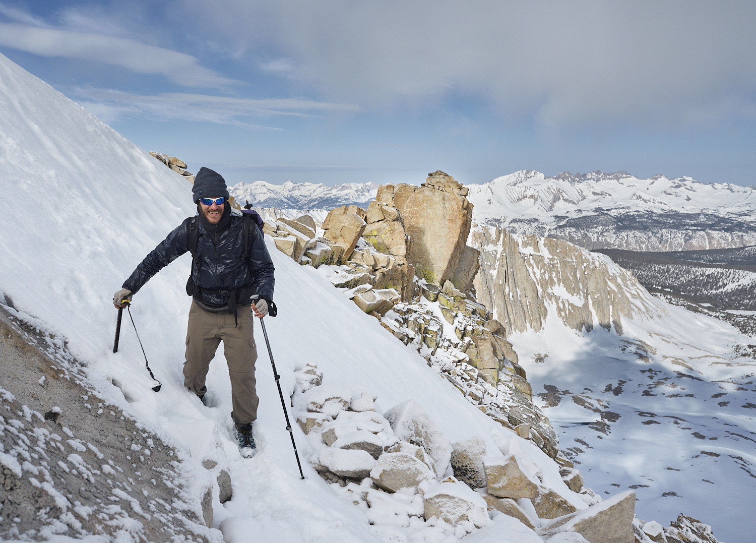
Descent from Bishop Pass. Susan, Lost and Found, and Gump climb a short slope to bypass a dangerous cornice. The Bishop Pass Trail, which crosses the 3,649-meter (11,972-foot) Bishop Pass, connects the Pacific Crest Trail in the south with the Bishop Creek Valley to the north. From there, a small road leads back to civilization — to Bishop — where a long-awaited rest day awaits.
Susan at the evening camp near Bishop Lake and Saddlerock Lake. Despite the cool air temperature, the warm late May sun makes for a pleasant evening. In the background on the right, the 4,236-meter (13,894-foot) Mount Agassiz is visible (the summit is cut off in the photo).
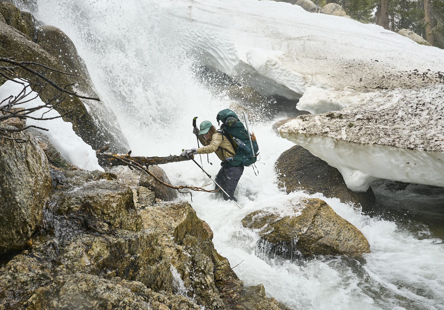
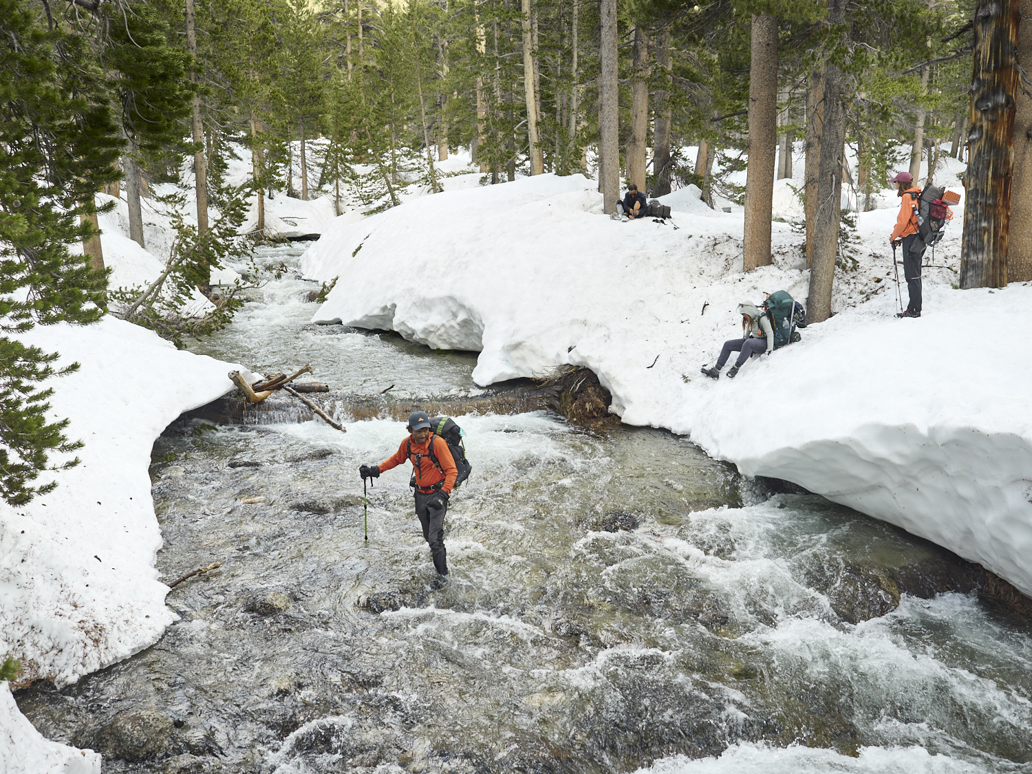
Lost and Found crosses Silver Creek. At this point, the PCT passes directly below the Silver Creek waterfall — an awe-inspiring atmosphere.
Lost and Found at Sunrise in the Sierra Nevada. Just before 6 a.m., only the peaks of the Sierra catch the first rays of sunlight. For a while longer, you still need warm clothing to protect against the cold. In the background, Sharktooth Peak (3,554 meters) is visible at the right edge of the image, and Silver Peak (3,620 meters) appears to the left of center.
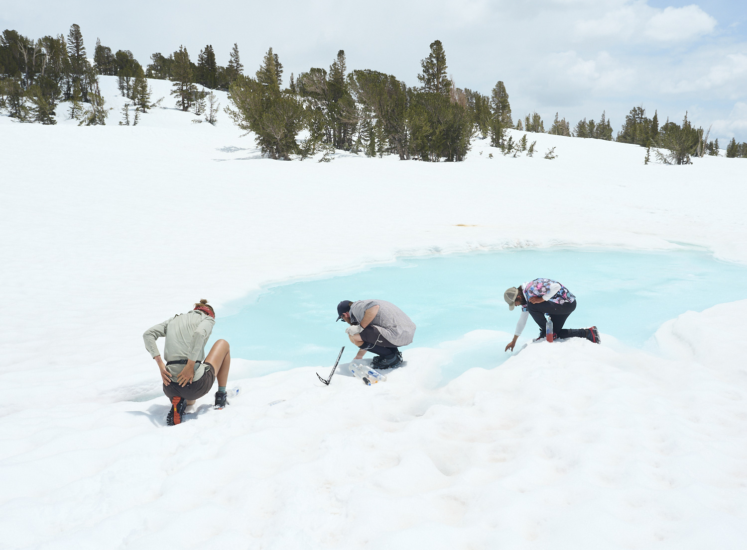
Hikers refill their bottles with water from a partially thawed lake.
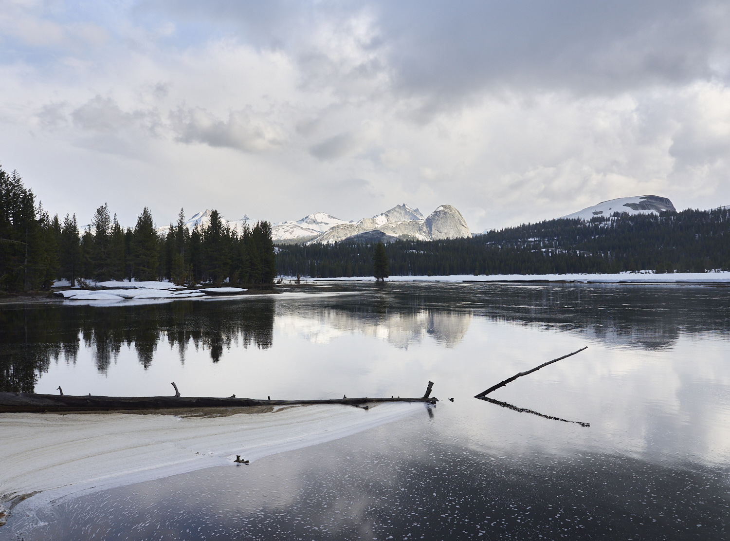
Yosemite National Park: During the spring snowmelt, following a winter with heavy snowfall, large areas of the flat Tuolumne River valley near Tuolumne Meadows are flooded. The gently rounded mountain slightly to the right of center is Fairview Dome, shaped by glaciers. Behind it, the Cathedral Range extends to the left, with its characteristically sharp peaks.
Hikers follow Spiller Creek, looking for a suitable place to cross.
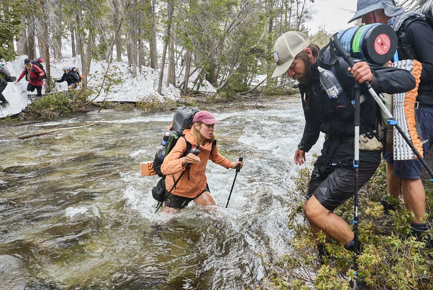
Susan crosses Spiller Creek in Yosemite National Park at a spot where the water reaches up to her waist. Due to its depth and strong current, crossing Spiller Creek was one of the more challenging river fords in the spring of 2023. We spent over 20 minutes searching for a suitable place to cross.
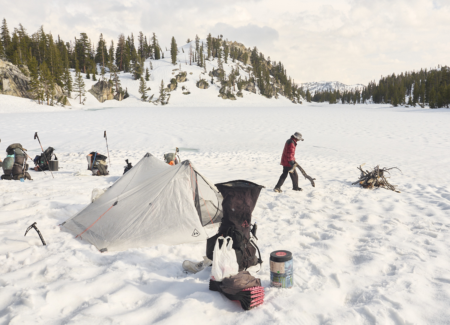
Setting up camp on the shore of the frozen Miller Lake at an elevation of around 2,900 meters. Oujin is gathering wood for the campfire.
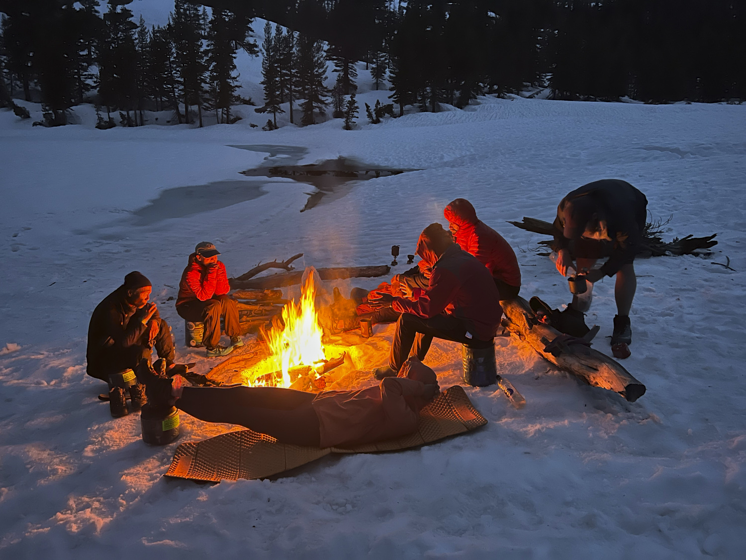
Campfire at Miller Lake in Yosemite National Park.
Cake and Tinman use a fallen tree to cross a river in Yosemite National Park.
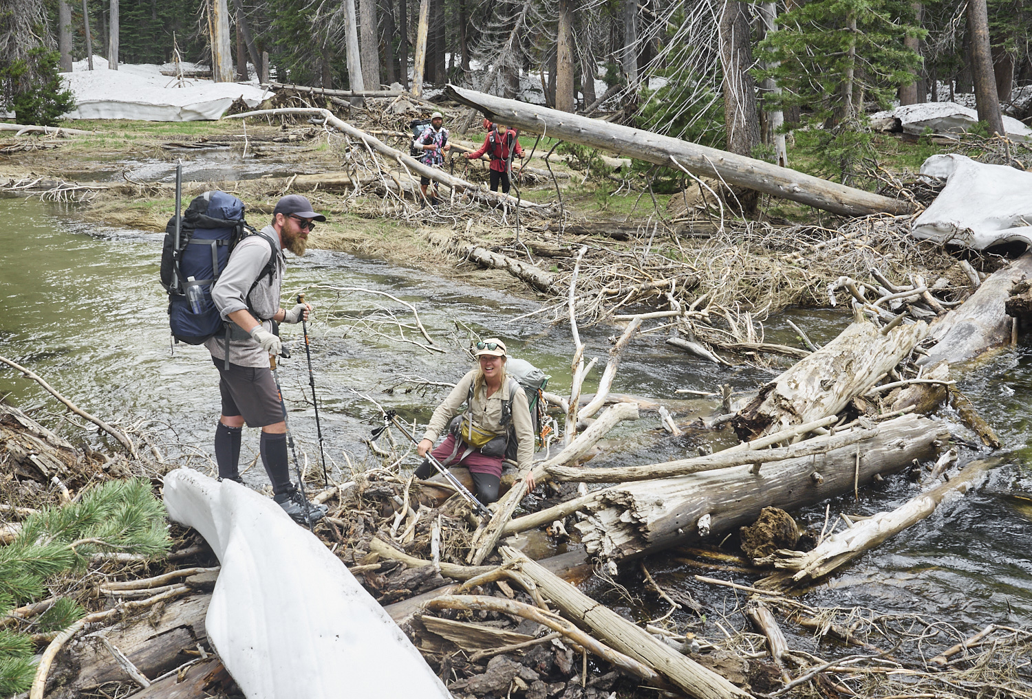
Although fallen trees often provide an easier and safer way to cross rivers, there is still a certain residual risk. In damp areas, the logs are often covered with an extremely slippery biofilm. Pits had to learn this the hard way at this spot – fortunately, the fall had no consequences.
Hikers cross a steep snowfield in Kerrick Canyon above Rancheria Creek. A slip at this point could have fatal consequences. This section is notorious among PCT hikers for its danger. In 2017 a hiker drowned while attempting to ford the river. In 2023 our crossing of this raging mountain stream was made easier by a snow bridge formed from the remnants of a winter avalanche.
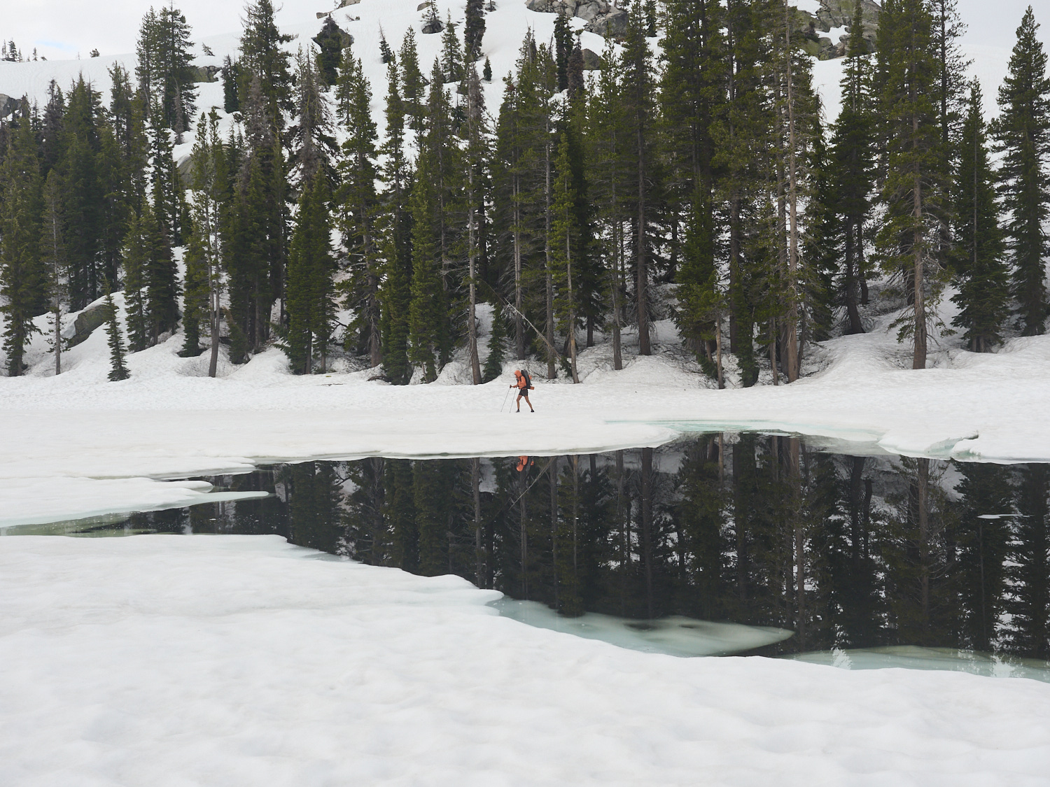
Susan crosses the ice-covered surface of Wilma Lake in Yosemite National Park. By mid-June at the latest, many lakes are only partially frozen, even after a snow-rich winter.
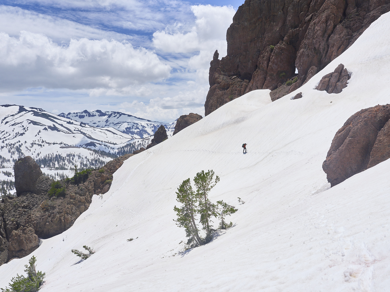
View along the PCT looking northwest from a pass between Dorothy Lake Pass and Sonora Pass. After more than four weeks of hiking and 500 kilometers of nearly continuous snow cover, we saw a wide, snow-free landscape for the first time. In a typical year, the PCT is snow-free from this point onward. That thought gave us hope, but in 2023 about 150 more kilometers with long stretches of snow-covered trail still lay ahead.
Well-deserved break in Kennedy Meadows (North). The pack station Kennedy Meadows North, located about ten kilometers west of Sonora Pass, is considered by long-distance hikers—just like the town of the same name roughly 500 kilometers further south—to mark the boundary of the High Sierra.
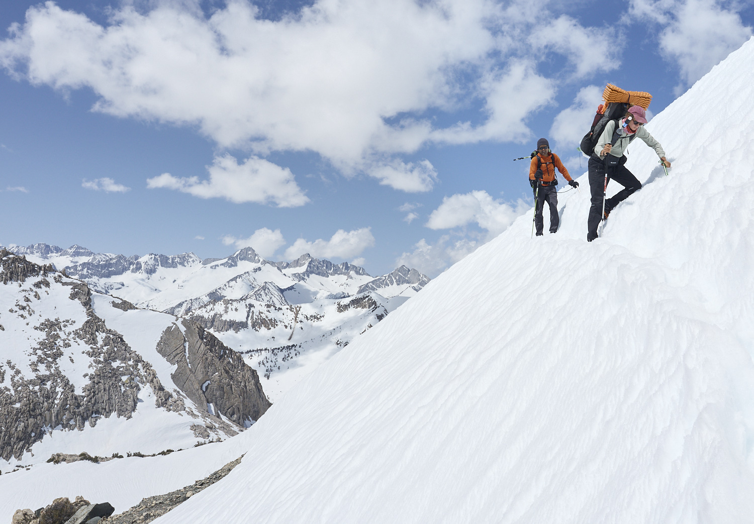
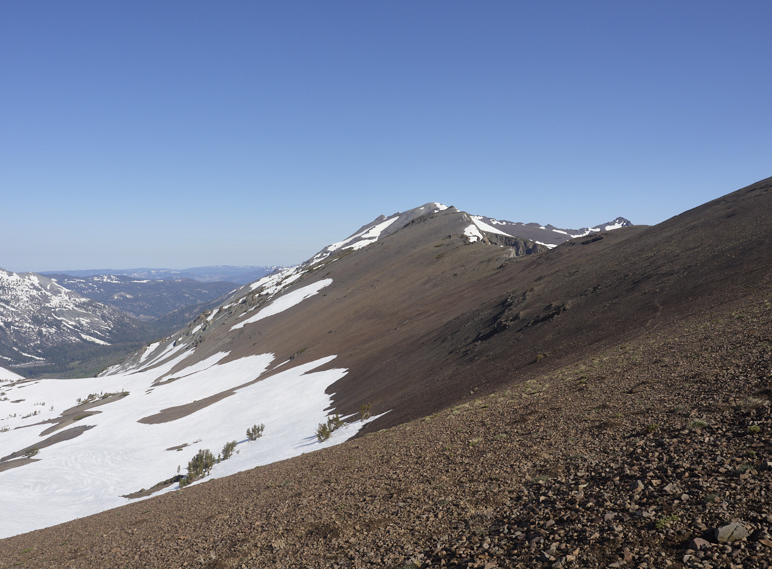
North of Sonora Pass, Gump fights his way up a steep, snow-covered slope of Sonora Peak at over 3,000 meters elevation. Although we had reached a snow-free section of trail for the first time in weeks the day before and had left Sonora Pass behind us, some 150 snowbound kilometers still lay ahead of us in 2023.
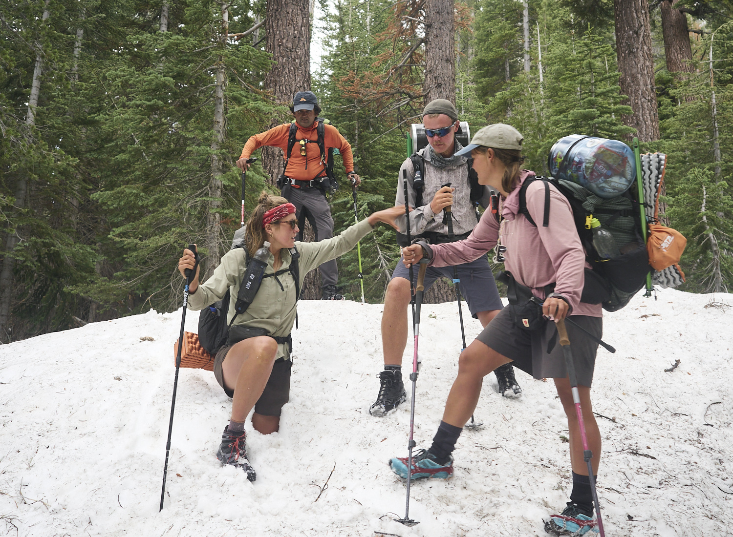
Susan gets help from Tinman to free her leg, which is almost completely stuck in a snow hole. During the snowmelt, treacherous cavities often form beneath the surface. Hikers can suddenly break through and, in extreme cases, find themselves stuck in snow up to their hips or even their chest. Branches or rocks hidden under the snow can sometimes cause injuries.
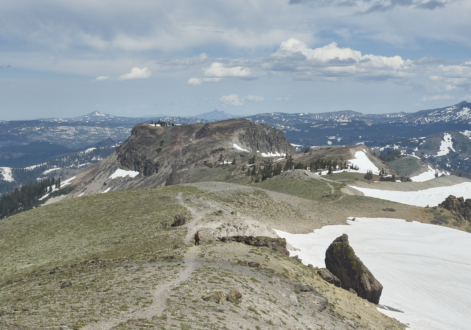
South of Donner Pass, between Tinker Knob and Anderson Peak, Gump hikes the PCT north toward Canada. At last, the trail is mostly free of snow. It’s late June, and in this section, the PCT stays between 2,000 and 2,500 meters in elevation. From now on, snowfields only need to be crossed for a few more days, mostly on north-facing slopes and in shaded forested areas at higher elevations. The broad, flat mountain with the distinctive rocky edges in the center of the image is Anderson Peak. Behind it, the sharp summit of Sierra Buttes (2,619 meters) rises on the horizon. At the foot of that mountain lies Sierra City — still about 80 kilometers away from here.
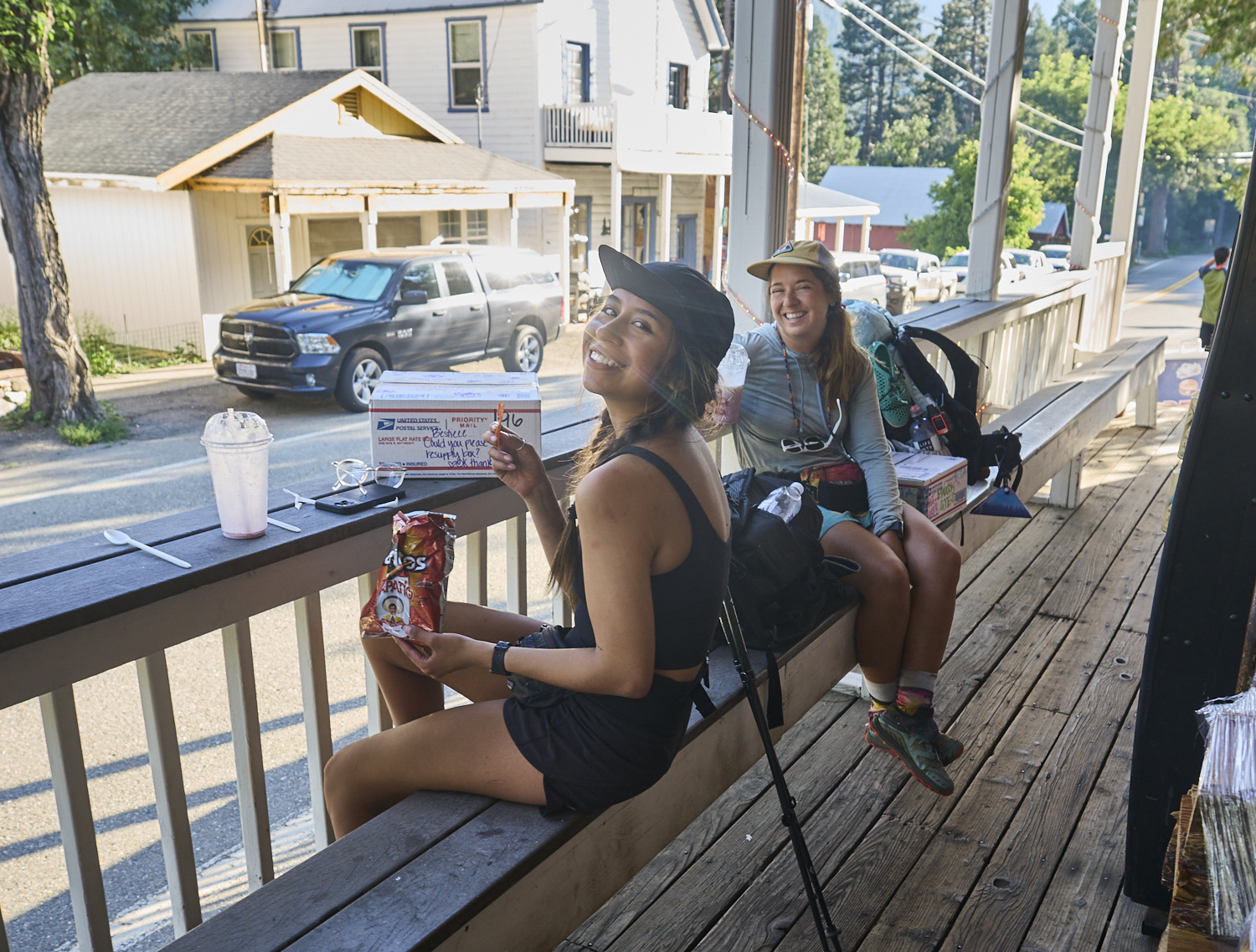
Hot Deal and Buffer enjoy snacks and milkshakes on the afternoon of July 1st, sitting on the porch of the Sierra City general store. It's hot and humid. From here on, the PCT winds through the dense, green forests of Northern California. The snowy high mountain adventure of the past few weeks is finally behind us. I'm sipping a cold beer and sweating in the 30-degree heat (Celsius) in the shade—hard to believe I spent the previous night on snow. It was my last night on snow during my 2023 PCT thru-hike.
Text
All texts and photos are protected by copyright